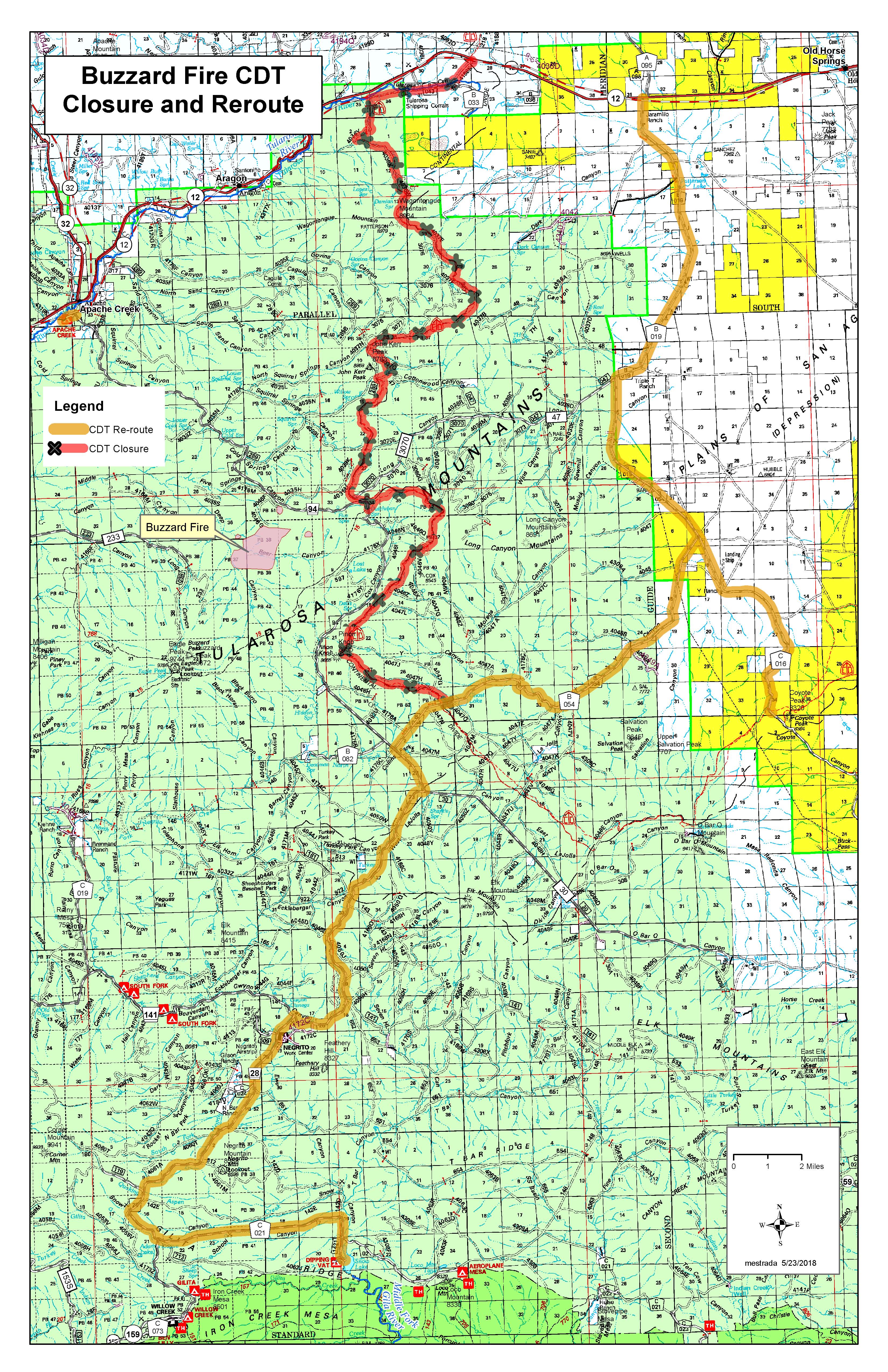
Reroute option #1– Continental Divide National Scenic Trail (CDNST) from the BLM boundary (between Coyote Peak and O Bar O Mountain) north to Highway 12. For hikers traveling north, the Plains of Saint Agustin route at Coyote Peak on the BLM-managed lands, when they get to Coyote Peak- take County Road B 016 north to B 019 north to Highway 12 west to CDT trailhead to resume route northbound.
Reroute Option #2– from Snow Lake- Middle Fork route. For hikers taking the alternate route through the Middle Fork/Snow Lake. Hikers should follow FR 28 to FR 94 to County Road B 054 to County Road B 016 to Highway 12.
Water containers will be set out for hiker consumption at the junction of FR 94 and County Road 054; and at the junction of Coyote Peak and County Road 16. Hikers are advised to fill up water at these locations as the remainder of the reroute will be dry. The water will only be available throughout the duration of the Buzzard Fire.
Hikers with questions should call the Reserve Ranger District office at 575.533.6232
For information on the Gila National Forest, check out the website at http://www.fs.usda.gov/gila or join the conversation on Facebook atwww.facebook.com/GilaNForest/ or follow on Twitter @GilaNForest.